The map
Sakurajima is located in Kagoshima. It used to be an island, but from the eruption of 1914 it joined the mainland of Kyushu.
The map= http://gojapan.about.com/library/map/blmap-kagoshima.htm
The Volcano
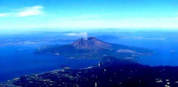
This is a picture of the Sakurajima volcano.
The Origin of It's Name
In Japanese Sakura means cherry blossom and Jima means island or mountain, but Sakurajima isn't a cherry blossom island. There are a lot of different sayings about how Sakurajima was named.
One is that a Goddess called "Konohana Sakuyahime" who appeared in legend was defined in Sakurajima, so people used to call Sakurajima, "Sakuya-jima" but then it changed over to "Sakurajima".
Another is that when the island was first created, cherry blossoms were seen floating over the see around the island.
Or that it was named after a local dignitary named "Sakurajima Tadanobu".
Basic Information.
|
- Elevation: 1,117 (3,665 ft) |
-Almost 700 people live at the foot of the volcano. |
The three peeks: Kitadake, Nakadake, & Minamidake
- Kitadake:
Pronunciation: keeta-dake
Meaning: Kita (north) Dake (peek)
- Nakadake:
Pronunciation: Naka-Dake
Meaning: Naka (middle or center) Dake (peek)
- Minamidake:
Pronunciation: Meena-mee-dake
Meaning: Minami (south) Dake (peek)
The Tools used
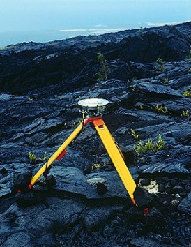
Here is a picture of a GPS or a Global Positioning System. Volcanologists use GPS as a powerful tool to detect movement at shallow depths beneath the surface of volcanoes.
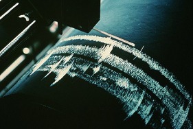
A Siesmometer is also used to measure and locate earthquakes.
